 Wow! eBook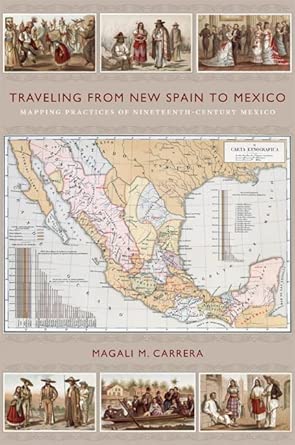
Traveling from New Spain to Mexico: Mapping Practices of Nineteenth-Century Mexico
Author(s): Magali M. Carrera (Author)
- Publisher: Duke University Press
- Publication Date: 3 Jun. 2011
- Edition: Illustrated
- Language: English
- Print length: 352 pages
- ISBN-10: 0822349760
- ISBN-13: 9780822349761
Book Description
From the sixteenth century until the early nineteenth, Europeans had envisioned New Spain (colonial Mexico) in texts, maps, and other images. In the first decades of the 1800s, ideas about Mexican, rather than Spanish, national character and identity began to cohere in written and illustrated narratives produced by foreign travelers. During the nineteenth century, technologies and processes of visual reproduction expanded to include lithography, daguerreotype, and photography. New methods of display-such as albums, museums, exhibitions, and world fairs-signaled new ideas about spectatorship. GarcÍa Cubas participated in this emerging visual culture as he reconfigured geographic and cultural imagery culled from previous mapping practices and travel writing. In works such as the Atlas geogrÁfico (1858) and the Atlas pintoresco É historico (1885), he presented independent Mexico to Mexican citizens and the world.
Editorial Reviews
Review
"
Traveling from New Spain to Mexico is well researched and documented in primary and secondary sources.... Carrera's clear and jargon-free writing makes the book enjoyable to read, and the abundant, well-chosen illustrations add to its enjoyment."--Paula Rebert "Hispanic American Historical Review""The elegant sweep of visual history within which Carrera places sophisticated readings of the Mexican cartographer's participation in nation-building discourse is a considerable achievement indeed. The extensively illustrated text and accessible prose will encourage specialist and non-specialist readers alike to get inside the visual narratives created by García Cubas in mapping his many Mexicos."--Deborah Toner "Journal of Latin American Studies"
"The newly independent nations of Latin America imagined themselves in ways that linked specific pasts to new, national identities. While each emerging nation-state did this slightly differently, Magali Carrera shows that Mexican intellectuals did this by visually constructing--mapping, drawing, photographing, exhibiting and even performing-- idealized narratives of Mexican history and geography that defined what it meant to be Mexican. And, Carrera does this in a well-written and visually profuse book that should interest Latin Americanist geographers working with questions of visual culture, national identity, or cartographic intention."--Karl Offen "Journal of Latin American History"
"In this original, theoretically sophisticated, and empirically rich book, Magali M. Carrera situates Mexican art and cartography in national and international contexts, gives the mapmaker Antonio García Cubas the scholarly attention he has long deserved, and connects his projects not only to nineteenth-century visual culture but also to colonial visual culture and travel narratives from the early independence era. It is a superb book, one that scholars of Mexican and Latin American history, art history, visual culture, and cultural studies will read and admire for years to come."--
Raymond B. Craib, author of Cartographic Mexico: A History of State Fixations and Fugitive Landscapes"
Traveling from New Spain to Mexico is an important book. It is distinctive in that it situates what we traditionally recognize as cartography in relation to post-independence Mexico's broader visual culture, patriotic and geographic literature, and even oratory. In addition, Magali M. Carrera grounds the work of late-nineteenth-century historians and geographers in the colonial experience of New Spain, allowing us to see how visual tropes changed across several centuries and in response to Mexico's independence and early national experience."--James R. Akerman, editor of The Imperial Map: Cartography and the Mastery of EmpireAbout the Author
Excerpt. © Reprinted by permission. All rights reserved.
TRAVELING FROM NEW SPAIN TO MEXICO
MAPPING PRACTICES OF NINETEENTH-CENTURY MEXICOBy Magali M. Carrera
DUKE UNIVERSITY PRESS
Copyright © 2011 Duke University Press
All right reserved.
ISBN: 978-0-8223-4976-1
Contents
List of Illustrations...............................................................................................xiiiPreface.............................................................................................................xixAcknowledgments.....................................................................................................1Introduction: Research and Theoretical Perspectives.................................................................191 Making the Invisible Visible......................................................................................392 Locating New Spain: Spanish Mappings..............................................................................633 Touring Mexico: A Journey to the Land of the Aztecs...............................................................1094 Imagining the Nation and Forging the State: Mexican Nationalist Imagery—1810–1860.....................1445 Finding Mexico: The García Cubas Projects—1850–1880..............................................1846 Traveling from New Spain to Mexico—1880–1911..........................................................2327 Performing the Nation.............................................................................................245Notes...............................................................................................................277Bibliography........................................................................................................317
Chapter One
MAKING THE INVISIBLE VISIBLE
In his preface to the Atlas geográfico, estadístico é histórico de la República Mexicana (1858), Antonio García Cubas states that during his preparation of the Atlas, he reviewed the works of "los Sres [Señores]. Moral, Humboldt, Garcia Conde, Teran, Rincon, Narvaez, Camargo, Lejarza, Orbegoso, Iberri, Harcort, Mora y Villamil, Robles, Clavijero, Prescot, Alaman, etc. etc." These sources, some going back to the eighteenth century, included cartographers as well as naturalists, political thinkers, and history writers. In addition, indicating his recognition of indigenous mapping traditions, García Cubas included in the Atlas geográfico, two supposed indigenous maps showing the migration of ancient peoples in Mexico (figures 49 and 50, chapter 5, p. 157 and p. 158).
While the cartographer and geographer is clear on the immediate sources of his Atlas geográfico, the Mexico of Antonio García Cubas's cartographic imagination was deeply embedded in mapping traditions and practices of previous centuries. Such mappings of the New World were initiated in the sixteenth century, continued into the seventeenth century, and, especially, expanded in the eighteenth century. Using diverse information-gathering methods and classifying concepts, these mappings resulted in displays of texts, images, and cartography. Concomitantly, travel was implicit in these mappings. In fact, until the eighteenth century, European readers were most likely to encounter the New World through popular edited collections of voyages or travel-related publications such as Giovanni Battista Ramusio's Delle navigationi et viaggi of 1555–65. Europeans mapped the Americas, therefore, through information gathered by processes and materials associated with two distinct and, at times, intertwined types of travel. The first was itinerary travel, associated with a route or path and visualized in cartographic images. Maps created for this kind of travel indicated how to get to and from the Indies, and once there, how to find one's way between points. The second was exploratory or sightseeing travel that was driven not so much by the linearity of a path as by circulation through the space of the Americas to ascertain natural resources and cultural content. Exploratory travel resulted in written texts and collections of flora, fauna, and material culture as well as noncartographic images, such as prints and frontispieces, and would have a great impact on how New Spain / Mexico was understood intellectually.
Through these travel modes, Europeans struggled to understand and discern the Indies as space as well as place. Space may be defined as an unbounded three-dimensional expanse (in which matter exists) that is ascertained through location in a particular rationale, such as a system of measurement providing relative position and direction within the graticule of longitude and latitude of a map. Place, on the other hand, is space that is embedded in the human experience of networks of geosocial and historical relations that produce collective meaning. While a place may be located on a map, its meaning cannot. As a result, the landmass of the Americas was located in physical relationship to other parts of the known world: its boundaries were defined and located within the compass lines of portolan charts and the graticule of longitude and latitude lines on maps and globes. At the same time, the natural and cultural substance of the Americas had to be fabricated, that is, situated in a European discourse that constructed imagined meanings of the Americas, forming it as a foil for European subjectivity. The cumulative effect of this fabrication was the formation of a space named the Americas, with its subset New Spain, into an ostensibly stable and coherent mapped entity.
Excellent cartographic histories of the Americas from the sixteenth century to the eighteenth may be found in numerous scholarly publications. While this is an account familiar to historians of cartography, I provide a general survey of the mapping traditions and visual practices that formed the Americas and New Spain for specialists in other fields. For this overview, I have divided the material into two chapters. This chapter broadly reviews those of non-Spanish-speaking countries of Western Europe from the sixteenth century to the eighteenth century. Although having less access to direct accounts and cartographic data about the Americas, these mappings—in the form of atlases, texts, and images—nevertheless proliferated and circulated broadly. In the following discussion, while highlighting examples of cartographic history, I focus on the development of the discursive imagery associated with maps (usually in frontispieces and marginalia) because these images reappear in mapping practices of the late eighteenth century and nineteenth century. Chapter 2 follows with a summary of the Spanish mapping processes and perspectives; here, access to direct information about the Spanish Americas produced distinctive texts and images.
These non-Spanish and Spanish mappings were neither linear or exclusive in their development nor necessarily summative in their results. It is possible, however, to ascertain broad visual themes resulting from these practices, which demonstrate that America / New Spain gained its meaning as place through iterative processes, erasures, and cumulative effects of multiple mappings. This survey demonstrates that centuries of attempts to represent the physical shape of New Spain, narrate its content, and invent its meanings formed both an enduring epistemological legacy and counterpoint for García Cubas's mapping practices of the nineteenth century.
MAPPING PRACTICES
In 1563, Duke Cosimo I de'Medici (1537–74), head of the Florentine Republic, commissioned the construction of an additional room for his Guardaroba, a storage area for highly valued palace goods such as tapestries, carpets, and sculpture, in his Palazzo Vecchio. Upon entering the Guardaroba Nuova, visitors found themselves surrounded by maps of the known world—fourteen of Europe, eleven of Africa, fourteen of Asia, and fourteen of the West Indies and Americas—painted on cabinet doors. Even more remarkable, the painted doors opened to reveal cupboards containing rare and precious objects from Cosimo's diverse assortment of exotica collected from the areas represented by the maps. These included Chinese porcelains, Turkish weapons, African ivory, and, from New Spain, Aztec feather works, masks, and statuettes. The curious and wondrous objects placed in the cabinets of Cosimo's Guardaroba Nuova were emblematic of distant worlds, at once exhibiting their craftsmanship, strangeness, wonder, and rarity." As Francesca Fiorani explains in The Marvel of Maps, having a cabinet of curiosities was not unusual for a European Renaissance prince; however, the association of maps that relied on Ptolemy's geographical order to catalog the artifacts was a unique format. The room exemplified a coming together of two modes—cartography and material culture—through which non-Spanish Western Europeans came to construct knowledge about the New World.
Cosimo's project is also representative of the expansion in mapping practices in the sixteenth century. Spain aggressively thwarted the publication of any unofficial information about the exact location or specific resources of its American kingdoms and limited the travel of foreigners to the Americas. Nevertheless, using available written sources, inexact mapping information, and spurious descriptions of the New World along with random objects (and sometimes indigenous people) sent back from the Americas, cosmographers and cartographers from the Netherlands, Eng land, and France produced extensive maps and images that convincingly fabricated descriptions of the West Indies.
Scholars generally agree that three factors spawned this explosion of mapping practices that occurred in the sixteenth century: the translation of Geographia by the second-century AD astronomer and cartographer Claudius Ptolemy; the invention of printing in Europe; and the undertaking of overseas voyages. Geographia included instructions for making map projections, proposals for breaking down the world map into larger-scale sectional maps, and the longitude and latitude coordinates for some 8,000 places. Ptolemy's Geographia was passed to Roman cartographers, lost in Medieval Europe cultures, and rediscovered in the Renaissance. Over time, new modes of map projection were experimented with and new data added to Geographia's maps and texts. The invention of printing techniques using metal plates provided the potential for increased circulation. In the resulting revised manuscript and printed world maps, America appeared as islands on the fringes of Asia or as a separate land in cartographic works such as those produced in the early part of the sixteenth century by Martin Waldsemüller, Peter Apian, Sebastian Münster, and Battista Agnese. By the last quarter of the sixteenth century, the American continent was confidently placed in coordinate-based spatial relation to Europe, Asia, and Africa.
At the same time, the contents of the Americas also had to be placed in cultural relationship to other lands. As a result, many sixteenth-century maps overflowed with images that depicted flora, fauna, and peoples added within or around the landmasses located by the map. Some of these images were based in pure fantasy; others were derived from explorers' accounts, such as the highly influential letter written by Amerigo Vespucci (1454–1512) in 1508. Under the flag of Portugal, this Florentine cosmographer and cartographer, who became chief pilot in Spain's Casa de la Contratación (House of Trade), which coordinated exploration of the West Indies, traveled during 1501 and 1502 from the African coast to the Brazilian coast. He wrote an account of his voyage in which he described the environment and people he encountered as part of a new continent, not islands on the fringes of Asia. The report was republished extensively in Europe as Vespucci's letter, entitled, Mundus Novus (New World). The various editions of his letter were associated with woodcut prints that depicted an environment with diverse flora and fauna and nude people, having an uncivilized culture that included cannibalism. The imagery associated with Vespucci's account furthered the linkage of Americas with natural abundance, diverse flora and fauna, savage people, and primitive cultures.
A growing sixteenth-century demand for maps resulted in the assemblage by Italian publishers of printed maps of different sizes and using different scales. Reconceptualizing the development of these books of maps, in 1570 Abraham Ortelius (1527–98) produced a bound set of maps that were uniform in size and organization of content, and integrated with explicatory texts. The resulting Theatrum Orbis Terrarum (Theater of the World) conceived as encyclopedic and the first true atlas became so popular that between 1570 and 1612, thirty-one editions were published in seven different languages. Gerard Mercator's (1512–94) Atlas sive cosmographicae, first published posthumously in 1595, used the term atlas for the first time in the title of a map collection. Well aware of Ortelius's Theatrum, Mercator did not recopy these maps but designed and engraved original maps using a uniform geometric projection based on information he had collected, including Spanish texts. For example, the atlas map of America was based on diverse information he had collected, including some Spanish texts (figure 1).
Mercator envisioned an all-inclusive scope for his Atlas. The frontispiece to the 1607 edition is indicative of his comprehensive vision (figure 2). Here, an almost nude male figure, with a globe at his feet and holding a celestial sphere, sits in a central niche within a columned structure that is similar to the Ortelian frontispiece. The upper part of this expanded architectural structure, however, supports the allegorical female figures representing Mexicana and Africa. Four additional niches surround the central figure and hold standing female allegories representing the geographic areas of Europa, Peruana, Asia, and Magalanica, the landmasses located by Magellan. All the figures, mostly nude except Europe and Asia, are associated with objects or animals representing their respective cultures within a highly structured composition. Here, the order and content of the known world are not determined solely by placement and costuming but through a rational order referenced by the architectural format with the niches as well as by the central figure who holds the geometrically measured globe.
While many scholars have noted the scientific contribution of Mercator's work to the history of cartography and geography, José Rabasa appraises the Atlas sive cosmographicae's role in the "invention" of America. He suggests that Mercator "historicized the geographer's eye," identifying geographic description as constituted by writing and history. Rabasa argues that the atlas becomes a cluster of signs, recognizable and comprehensible in discursive configurations and through Mercator's bricolage of diverse information, cartographic and geographic and historical fragments are fabricated into the appearance of wholeness. "We must understand the [Mercator's world] map, and the Atlas in general, as simultaneously constituting a stock of information for collective memory and instituting a signaling tool for scrambling previous territorializations. Memory and systematic forgetfulness, fantastic allegories and geometric reason coexist in the Atlas without apparent disparity." Explaining geography as a series of erasures and over-writings, Rabasa concludes that through the atlas format, territories could be erased and reconstituted in images and texts to endorse specific points of view, agendas, and so forth. The America found in Mercator's Atlas is now the sum total of an allegorical figure, a fabricated map, and a contrived text. The Atlas sive cosmographicae, and atlases in general, become mnemonic devices simultaneously instituting a systemic forgetfulness and prescribed remembering through what appears as the naturalness of geometric order.
Gerard Mercator, then, went beyond the Ptolemaic compiling format to structure an illustrated travel narrative that appeared to be a comprehensive revelation of history and its spaces. The Atlas's seemingly irrefutable and overwhelming truth—apparent in its maps, images, and texts—hides its highly subjective and constructed armature, accepted as the objectivity of geometry and historical and cultural facts.
This imagined content and meaning of the Americas continued to proliferate in European maps and atlases of the seventeenth century. For example, in 1634, Willem Janszoon Blaeu (1571–1638) visualized a project to compete with Mercator's production: a monumental folio atlas that was titled Theatrum Orbis Terrarum and came to be known as the Atlas Maior, consisting of two volumes with 204 maps. After his death in 1638, Willem's sons, Cornelius and Joan, extended the atlas into a six-volume set. In the Blaeus' Theatrum Orbis, the map of the American continent is set in the graticule of longitude and latitude with small ships sailing to and from it and surrounded by phantasmagoric sea monsters still believed to threaten travelers (figure 3). Above the map are cartographic and chorographic images of seaports and cities of America Septentrionalis and America Meridionalis (North America and South America), such as Havana, Santo Domingo, Mexico City, and Cusco. On the sides of the map, ten vignettes illustrate supposed types of indigenous peoples who inhabit the landmass. While perhaps surpassing Mercator's Atlas sive cosmographicae in scale and extended content, that of Blaeu repeated the comprehensive ordering of the atlas format as it continues to function as a mnemonic device.
(Continues...)
Excerpted from TRAVELING FROM NEW SPAIN TO MEXICOby Magali M. Carrera Copyright © 2011 by Duke University Press. Excerpted by permission of DUKE UNIVERSITY PRESS. All rights reserved. No part of this excerpt may be reproduced or reprinted without permission in writing from the publisher.
Excerpts are provided by Dial-A-Book Inc. solely for the personal use of visitors to this web site.


