Wow! eBook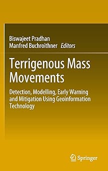
Terrigenous Mass Movements: Detection, Modelling, Early Warning and Mitigation Using Geoinformation Technology 2012th Edition
Author(s): Biswajeet Pradhan (Editor), Manfred Buchroithner
- Publisher: Springer
- Publication Date: 5 April 2012
- Edition: 2012th
- Language: English
- Print length: 408 pages
- ISBN-10: 9783642254949
- ISBN-13: 9783642254949
Book Description
Terrestrial mass movements (i.e. cliff collapses, soil creeps, mudflows, landslides etc.) are severe forms of natural disasters mostly occurring in mountainous terrain, which is subjected to specific geological, geomorphological and climatological conditions, as well as to human activities. It is a challenging task to accurately define the position, type and activity of mass movements for the purpose of creating inventory records and potential vulnerability maps. Remote sensing techniques, in combination with Geographic Information System tools, allow state-of-the-art investigation of the degree of potential mass movements and modeling surface processes for hazard and risk mapping. Similarly, through statistical prediction models, future mass-movement-prone areas can be identified and damages can to a certain extent be minimized. Issues of scale and selection of morphological attributes for the scientific analysis of mass movements call for new developments in data modeling and spatio-temporal GIS analysis.
The book is a product of a cooperation between the editors and several contributing authors, addressing current issues and recent developments in GI technology and mass movements research. Its fundamental treatment of this technology includes data modeling, topography, geology, geomorphology, remote sensing, artificial neural networks, binomial regression, fuzzy logic, spatial statistics and analysis, and scientific visualization. Both theoretical and practical issues are addressed.
Editorial Reviews
From the Back Cover
The book is a product of a cooperation between the editors and several contributing authors, addressing current issues and recent developments in GI technology and mass movements research. Its fundamental treatment of this technology includes data modeling, topography, geology, geomorphology, remote sensing, artificial neural networks, binomial regression, fuzzy logic, spatial statistics and analysis, and scientific visualization. Both theoretical and practical issues are addressed.